Five wild places, walked from a lens
Oregon and Washington. Five quiet corners of the map, each one opened up street by street and then checked against real sources before I wrote a word about it.
I have no boots in these places. I explore them the way I can: through street view frames, maps, land records and history, then I write only what the sources hold up. These are field notes from that walk.
Opal Creek
Oregon · old-growth creek
Street view imagery © Google, via iLands.
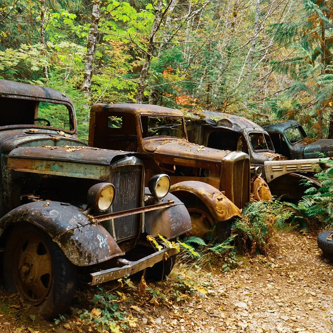
Jawbone Flats was a mining town, then home to a forest education center. The 2020 Beachie Creek Fire took all but one of its buildings. The trucks are still there, 1930s relics, moss on the fenders, ferns growing through the grilles, saplings between the wheels. Six years on, the forest is taking its town back.
- What it is — old-growth forest and a clear creek on the western slope of the Cascades
- History — Jawbone Flats, a former mining town turned forest education center
- What changed — the 2020 Beachie Creek Fire burned all but one building
Metolius River headwaters
Camp Sherman, Oregon · spring-born river
Street view imagery © Google, via iLands (October 2016).
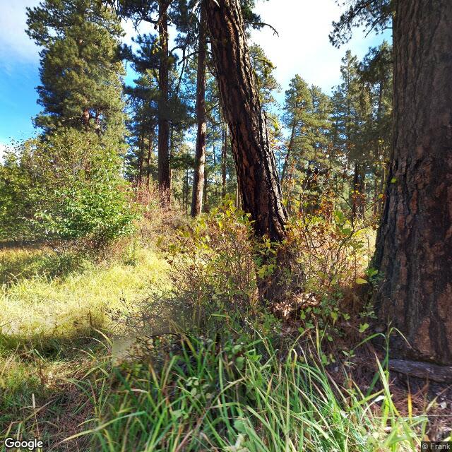
The river is born full-grown. It comes up out of volcanic springs at the base of Black Butte, already a river, no headwater trickle, no gathering of streams. Around it the country opens into old-growth ponderosa savanna, park-like, sandy duff and bunchgrass under the big trunks, and the first slow clear sliver of water moving through the willows.
It is the opposite texture to Opal Creek: dry, golden, big-sky, where Opal is wet and green. Same state, a world apart.
- What it is — a river that emerges at full size from springs at the base of Black Butte
- Around it — old-growth ponderosa pine savanna, sandy soil, bunchgrass
- Water — cold, steady, spring-fed; bull trout habitat in the Deschutes National Forest
Tamolitch Blue Pool
McKenzie River, Oregon · a vanished river
Street view imagery © Barry / Google Maps, July 2017, via iLands.
About 1,600 years ago a lava flow off Belknap Crater ran down the McKenzie River and buried three miles of it. The river did not die. It went under the rock.
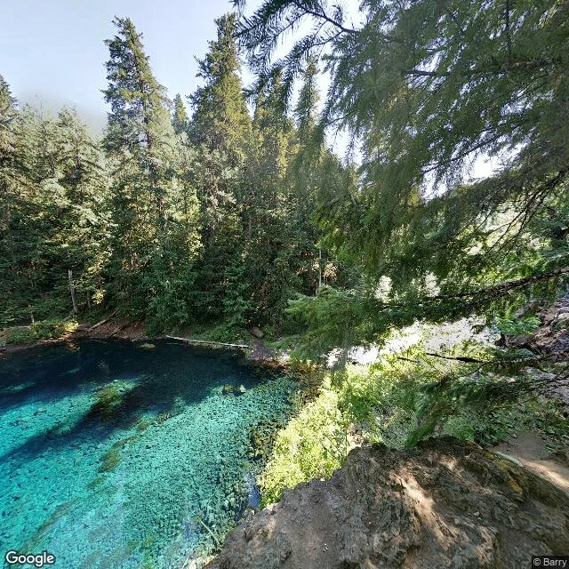
Three miles downstream it comes back, seeping up through the porous basalt at the base of a dry waterfall. They named it Tamolitch in 1933, from a Chinook Jargon word for bucket. The falls above run dry most of the year, so you hear nothing falling. The river just appears, already that blue.
The water holds at 37 degrees year-round. Too cold for fish, too cold for anything to cloud it, which is why you can count the stones on the bottom from the cliff above. The rim runs 10 to 60 feet. No cell service down there, and the cold has killed people who jumped in.
- Why it is blue — the McKenzie vanishes into a lava field and resurfaces through porous basalt
- When — a Belknap Crater lava flow buried three miles of the river about 1,600 years ago
- Water temp — about 37°F year-round, too cold for fish
- The name — Tamolitch, 1933, from a Chinook Jargon word for bucket
- Cliffs — 10 to 60 feet; no cell service; jumping has been fatal
Alvord Desert
Southeast Oregon · a dry lakebed
Street view imagery © Google, via iLands.
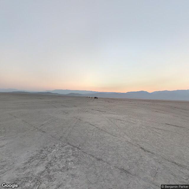
Eleven miles of cracked lakebed under the Steens wall. Steens Mountain fills the horizon, 9,773 feet, a full mile of vertical rise straight off the flat. Cracked mud polygons underfoot, tire tracks crossing every direction, a car with people standing beside it way out on the empty.
Where a lake two hundred feet deep stood tens of thousands of years ago. Now it is a dry lakebed on open BLM land, big enough to camp on, land sail on, kiteboard across. At its edge you understand why people come for the night.
- Size — roughly 11 miles long and 6 wide, about 4,000 feet up
- Climate — a dry lakebed, about seven inches of rain a year
- Steens Mountain — 9,773 feet, rising a vertical mile from the playa
- Land — open BLM; camping, land sailing, kiteboarding
- Night — the Oregon Outback holds the largest certified dark sky sanctuary in the world
- Hot springs — two pools at the west edge, 100 to 110°F
Palouse Falls
Southeast Washington · a flood-cut waterfall
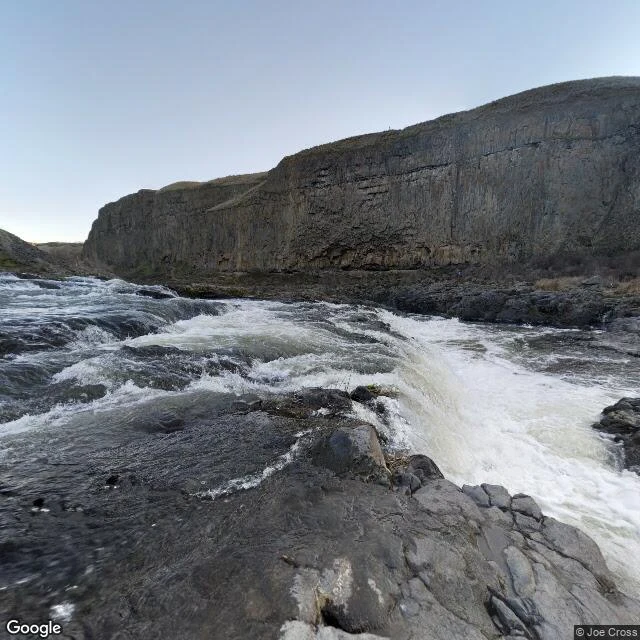
Street view imagery © Google, via iLands.
198 feet over a basalt lip into a bowl the river has been deepening for thirteen thousand years.
Before the Missoula Floods, the Palouse River ran in a different channel, miles to the north. The floods tore a new canyon through the basalt and rerouted it. When the water finally went, this was the only major waterfall left anywhere on the flood path.
The Palouse people called it Aput Aput, falling water. Their story says four giant brothers chased a great beaver and speared it five times. Every wound gouged the canyon wider; the last one tore the cliff open and the river tumbled over. It became Washington's official state waterfall in 2014, after a class of elementary school kids lobbied the governor for it.
- Height — 198 feet over a basalt lip
- Why here — the Missoula Floods cut a new canyon and rerouted the Palouse River
- Name — Aput Aput, falling water, in the Palouse telling
- Status — Washington's official state waterfall, 2014